Hurricane Kiko has formed in the eastern Pacific Ocean, according to the National Hurricane Center. As of Tuesday, the storm is located approximately 1,840 miles east of Hawaii, packing maximum sustained winds of 75 mph. It’s currently moving westward at a relatively slow pace of 7 mph.
While Kiko poses no immediate threat to land, forecasters predict steady strengthening over the next few days. No coastal watches or warnings have been issued at this time. The storm’s trajectory and intensity will continue to be monitored closely by meteorological agencies. Stay tuned for updates as the situation develops.
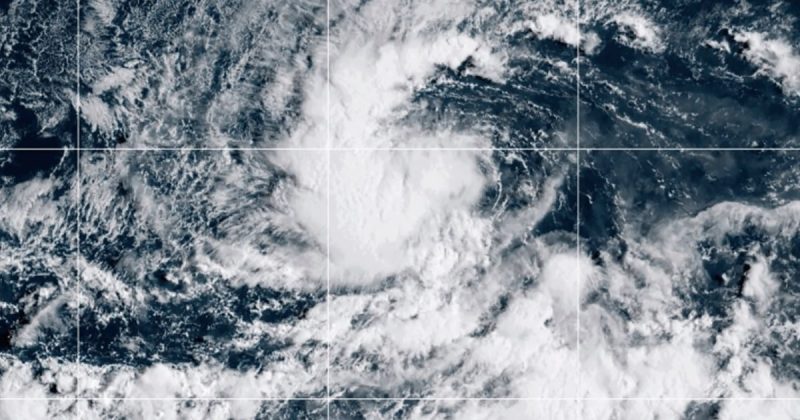
The image released by NOAA via AP shows the impressive satellite view of the storm, highlighting the swirling nature of the hurricane. This visual serves as a reminder of the power and potential danger of these weather systems, even when they’re not immediately impacting populated areas. The ongoing monitoring and predictions provided by the National Hurricane Center are crucial for preparedness and safety in the affected regions.
For those interested in following the progression of Hurricane Kiko and other tropical weather systems, the National Hurricane Center’s website and social media channels are excellent resources. Regular updates and detailed forecasts are provided there, ensuring the public is informed about potential risks and can take appropriate precautions.