The recent catastrophic flooding in Texas’ Hill Country was a tragedy of immense proportions, leaving a trail of destruction and heartbreak. Experts are pointing to a confluence of factors – a truly ‘perfect storm’ – that conspired to unleash such devastating consequences. It wasn’t just rain; it was a complex interplay of atmospheric conditions, geographical features, and perhaps even a degree of unfortunate timing.
At the heart of the disaster was a slow-moving pocket of intensely moist air. This system lingered over the region for an extended period, dumping torrential rainfall onto already parched land. The dry ground, unable to absorb the deluge, resulted in rapid runoff, swelling creeks and rivers far beyond their capacity.
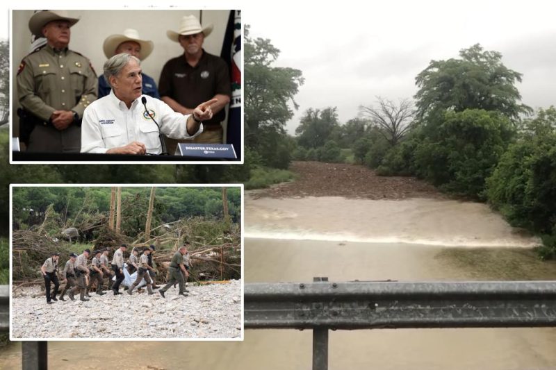
Adding to the problem was the Hill Country’s unique topography. Its rolling hills and steep inclines, while beautiful, are inherently prone to flash flooding. The rapid descent of water from higher elevations funneled immense volumes of water into lower-lying areas, exacerbating the already critical situation. The speed and volume of the floodwaters left many with little to no time to react or escape.
The combination of these factors – prolonged rainfall, dry ground, and challenging terrain – created a situation where even relatively moderate rainfall could have catastrophic consequences. It highlights the vulnerability of certain regions to extreme weather events, and underscores the need for improved forecasting, early warning systems, and community preparedness.
The devastation caused by this flood is a stark reminder of the power of nature and the importance of understanding the complex interactions that can lead to such extreme events. As communities begin the long process of recovery, lessons learned from this tragedy must inform future preparedness strategies and infrastructure development to mitigate the risks of similar events in the future.